
Supporting Safe and Efficient Flight Operations
ARVI is an Aviation Weather Service that supports safe and efficient aircraft operations.
ARVI (basic service), with its wealth of information and sophisticated UI, ensures more efficient operational support,
while 3D ARVI proposes a new briefing format using state-of-the-art technology and a 3D display.
It also contributes to the digitization of flight operations.

Provided by the latest technology and 3D display
Next Generation Briefing Tools
JAXA’s world-first 3D visualization technology combined with airline company operational know-how
This service supports safe and efficient aircraft operations by incorporating “Lightning Danger Area Prediction Technology”.
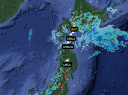
Easy-to-understand 3D representation of various weather conditions
Various weather conditions such as rain and clouds, including areas at risk of lightning strikes, are clearly represented in 3D.
By selecting and overlaying each condition, it is possible to intuitively grasp the current weather conditions.
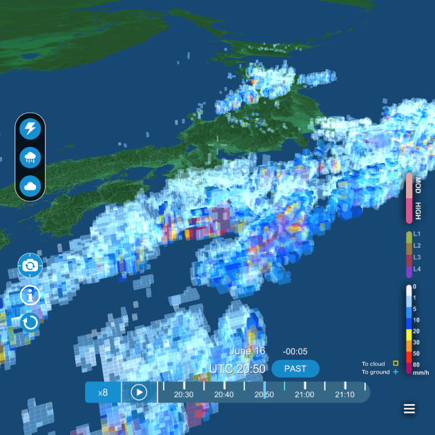
3D image of rain
3D image of cloud
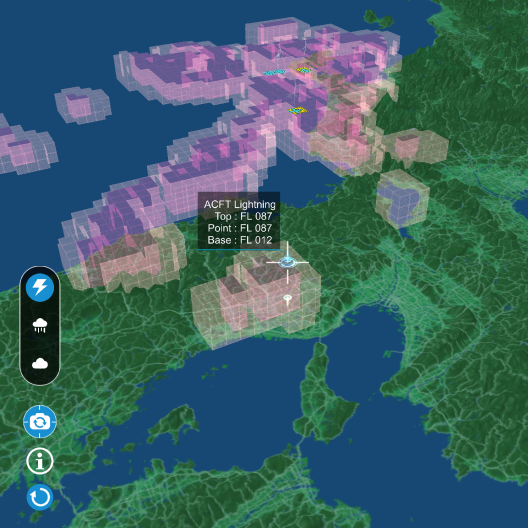
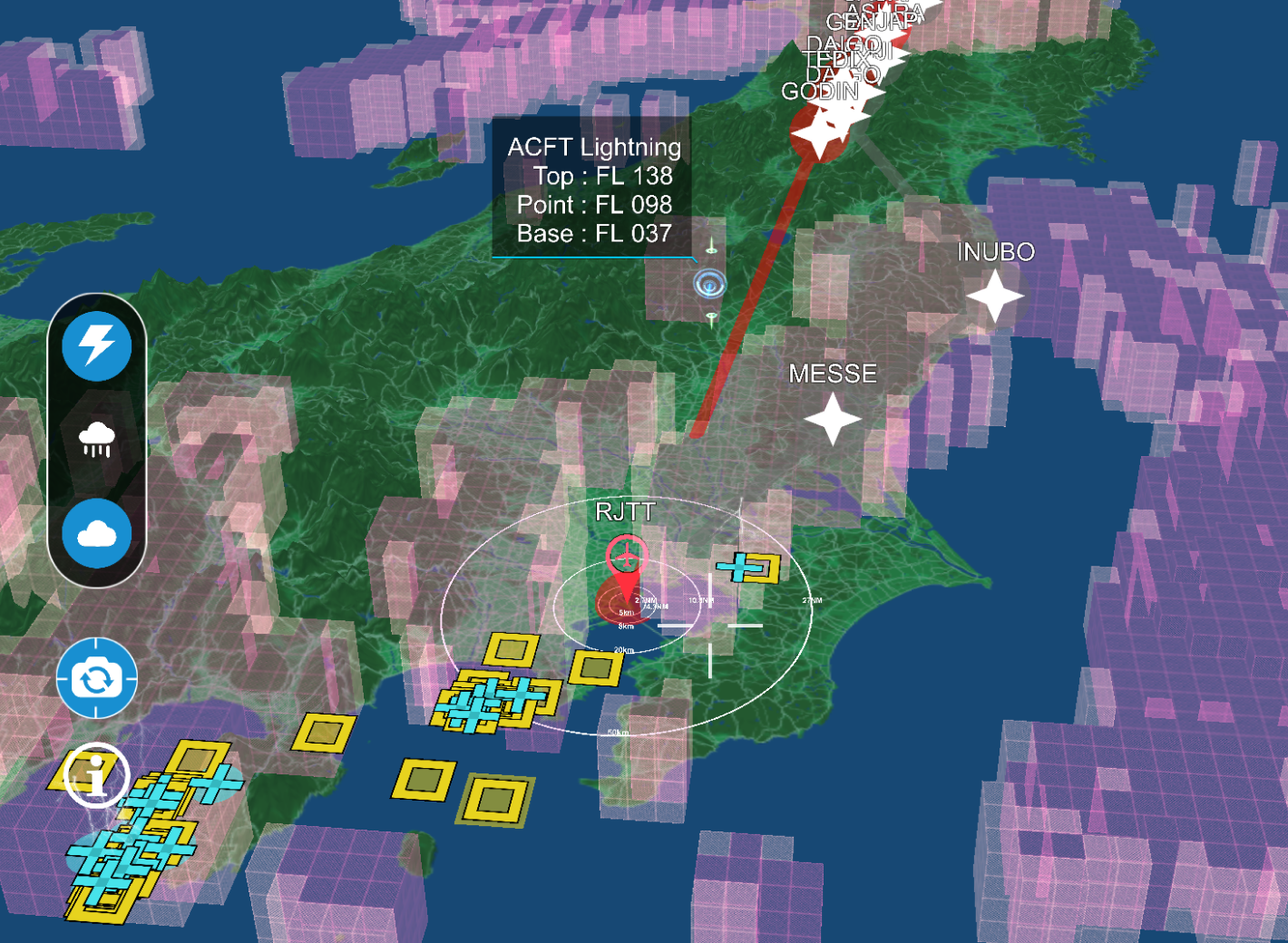
3D image of the area at risk of being struck by lightning
Using JAXA data,
3D rendering of areas where aircraft may be struck
by lightning (patent pending)
Equipped with the world’s first technology that predicts potential lightning strike areas
by analyzing past aircraft lightning strike records and meteorological data.
This can drastically reduce maintenance costs due to lightning strikes,
which are a major burden for airlines.
Briefing available at any time
3D ARVI is portable on mobile devices. Get the latest weather information not only in the office,
but also while at home, on business trips, and even on the plane if you are online.


Support quick and optimal decision making
ARVI supports airlines in achieving safe flight operations and efficient decision-making
by displaying weather and disaster information on a single screen,
which can have a significant impact on flight operations.
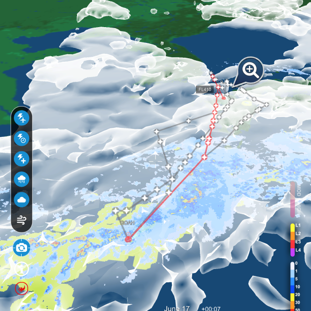
Weather x Flight Plan
By overlaying weather and flight plans, you can instantly see the weather affecting your flight.
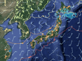
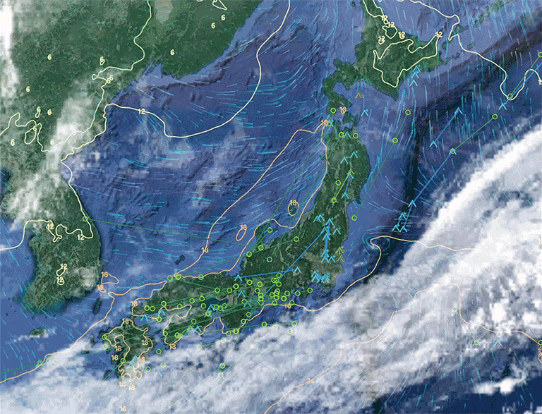
Diverse weather data
It improves operational efficiency by working smoothly even when large amounts of weather data are stacked on top of each other.
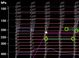
Cross-sectional mode
View meteorological cross sections, which are important for altitude selection, according to the flight plan.
It supports quick decision-making for airline operators by presenting weather information in an intuitive and easy-to-understand manner.
Digitization Support Services

We are committed to providing our clients with the full range of digital expertise, ideas, and experience that we have accumulated over the years as they seek to promote digitalization.
MTI has been recognized in a wide range of fields and has been selected by Ocean Network Express Pte. Ltd., which has a network in over 120 countries around the world, as a partner company to operate its system development division and to support digital human resource development.
We also help companies in the airline industry improve their operational efficiency.
Please contact us first for more information.